
iGeoT: Inverse Multicomponent Geothermometry
iGeoT is a software framework supported by a graphical user interface that combines multicomponent geothermometry and automatic estimation of uncertain parameters that need to be known to reconstruct the composition of deep fluids.
Geochemical Speciation
GeoT/iGeoT is a geochemical speciation software that was developed primarily to estimate the temperature of deep geothermal reservoirs, using analyses of a full suite of dissolved constituents in water samples. However, this software is also practical to quickly compute the distribution of chemical species, pH, pe, and mineral saturation indices in water samples at specific temperature intervals over prescribed temperature ranges. When doing so, an option is available to react water samples with specific minerals and/or gases and compute the resulting aqueous phase composition over the scanned temperature range. Multiple water compositions can be processed in this way, simultaneously, making this software a practical tool to quickly assess the geochemistry of groundwaters for a range of applications not necessarily related to geothermometry.
Multicomponent Geothermometry

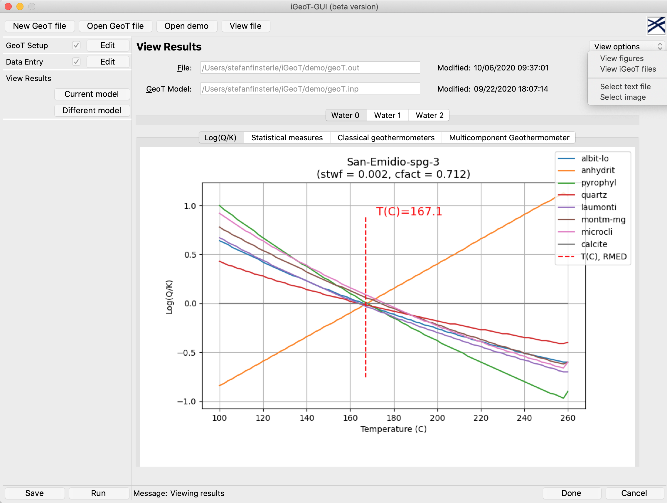
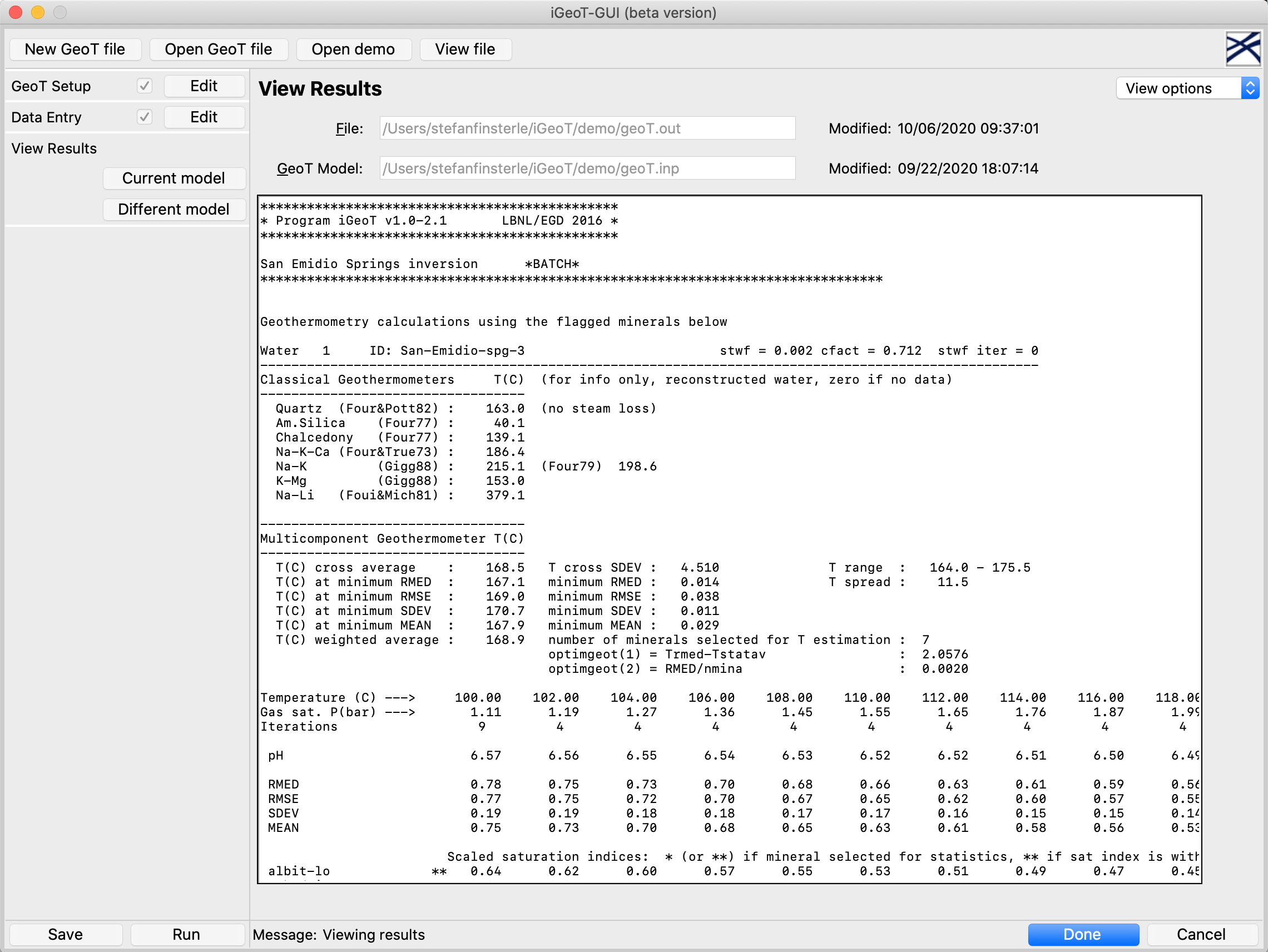
Computed saturation indices as a function of temperature, showing clustering near zero.
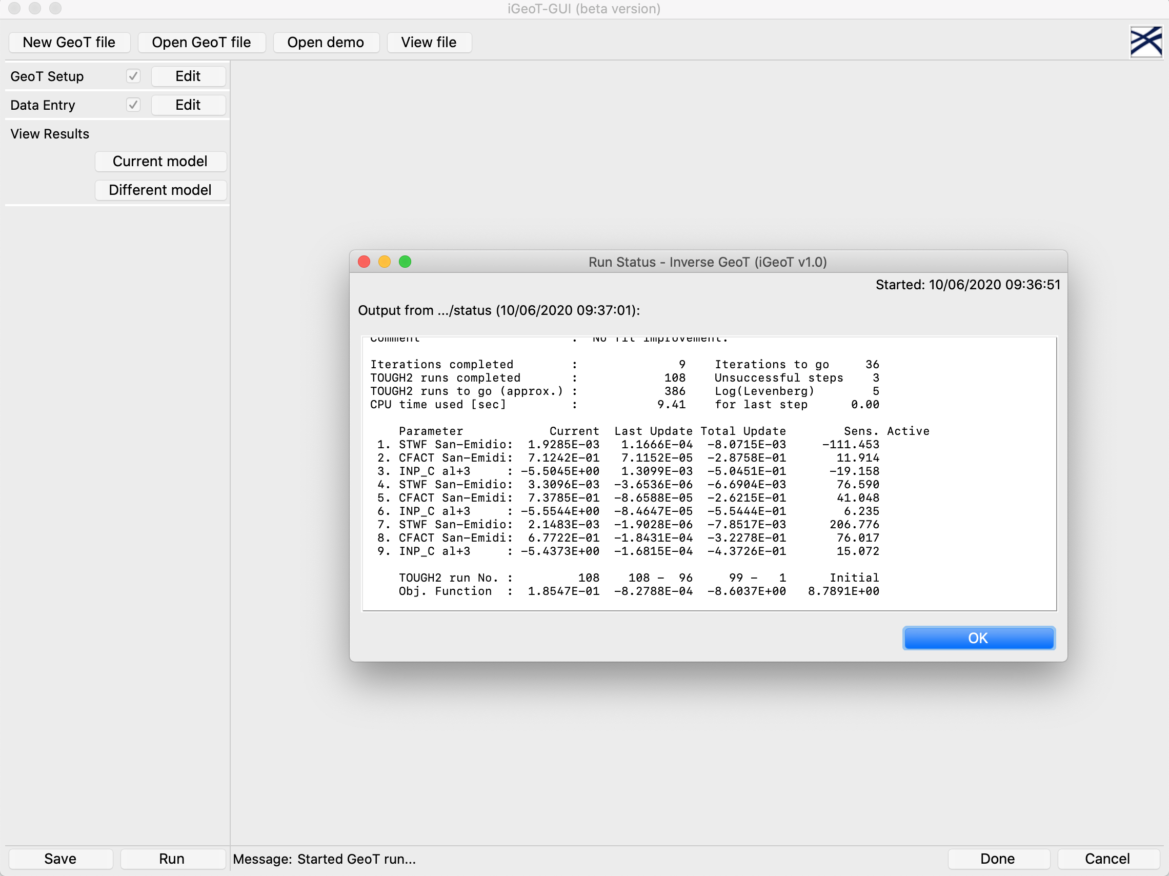
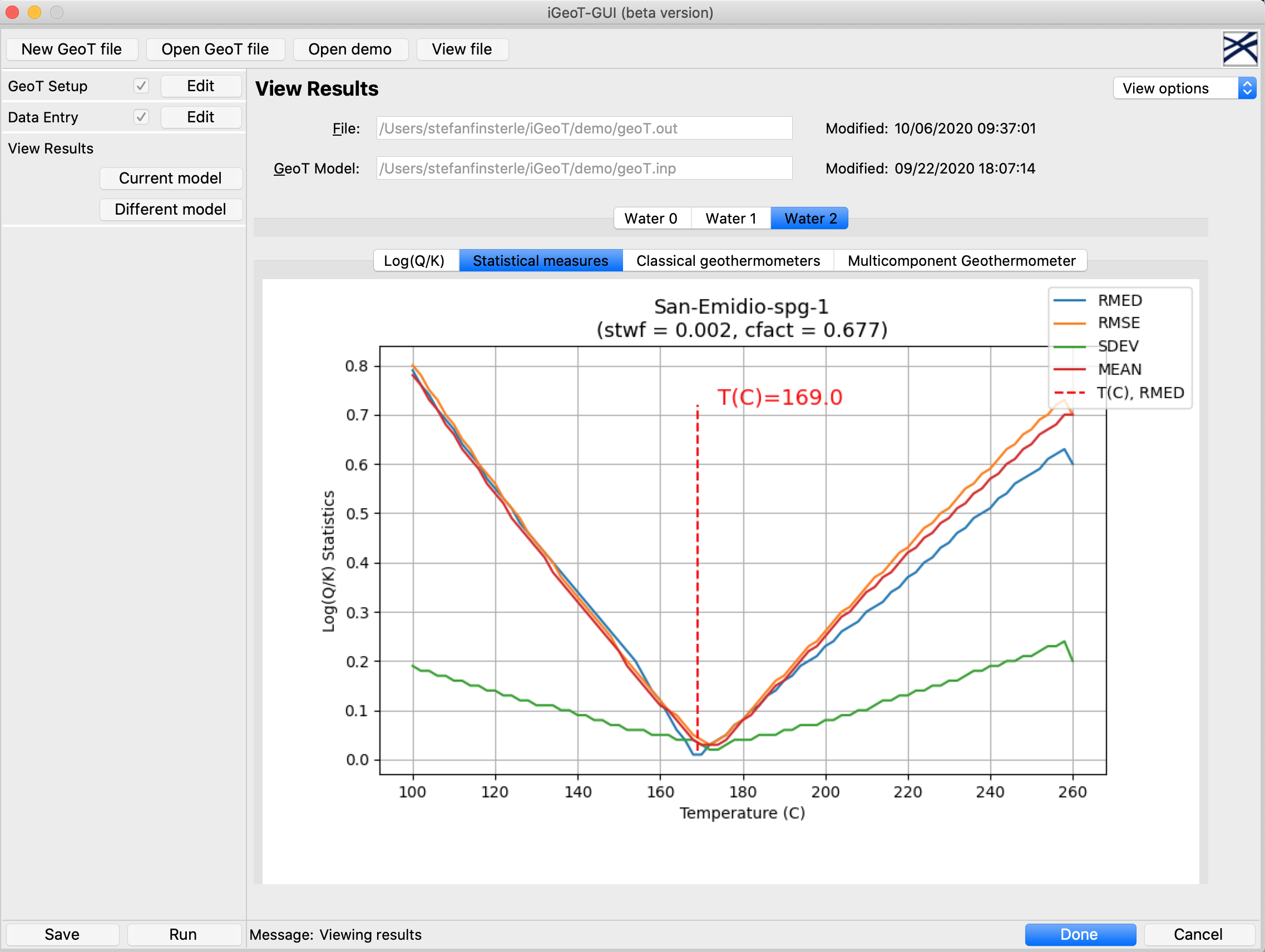
iGeoT’s multicomponent geothermometer is based on the method developed by Reed and Spycher (Geochim. Cosmochim. Acta, 43(7), 513–528, 1984), which estimates geothermal reservoir temperatures using full and integrated chemical analyses of geothermal fluids. Reservoir temperatures are estimated from statistical analyses of mineral saturation indices computed as a function of temperature. iGeoT reconstructs the deep geothermal fluid compositions and performs geothermometry computations. The method consists of using full chemical analyses of water samples to compute the saturation indices of reservoir minerals over a range of temperatures. Moreover, numerical optimization is used to estimate unknown or poorly constrained input parameters by numerical optimization. Ideally, the intersection points of the temperature-dependent saturation indices for different reservoir minerals are tightly clustered around the estimated reservoir temperature. In iGeoT, a nonlinear least-squares problem is solved, where the difference of multiple clustering measures from their optimal value is minimized by automatically adjusting the uncertain parameters, such as the amount of dilution, the steam fraction and composition of exsolved gases, and the concentrations of solutes that may have been affected during re-equilibration.
iGeoT Graphical User Interface

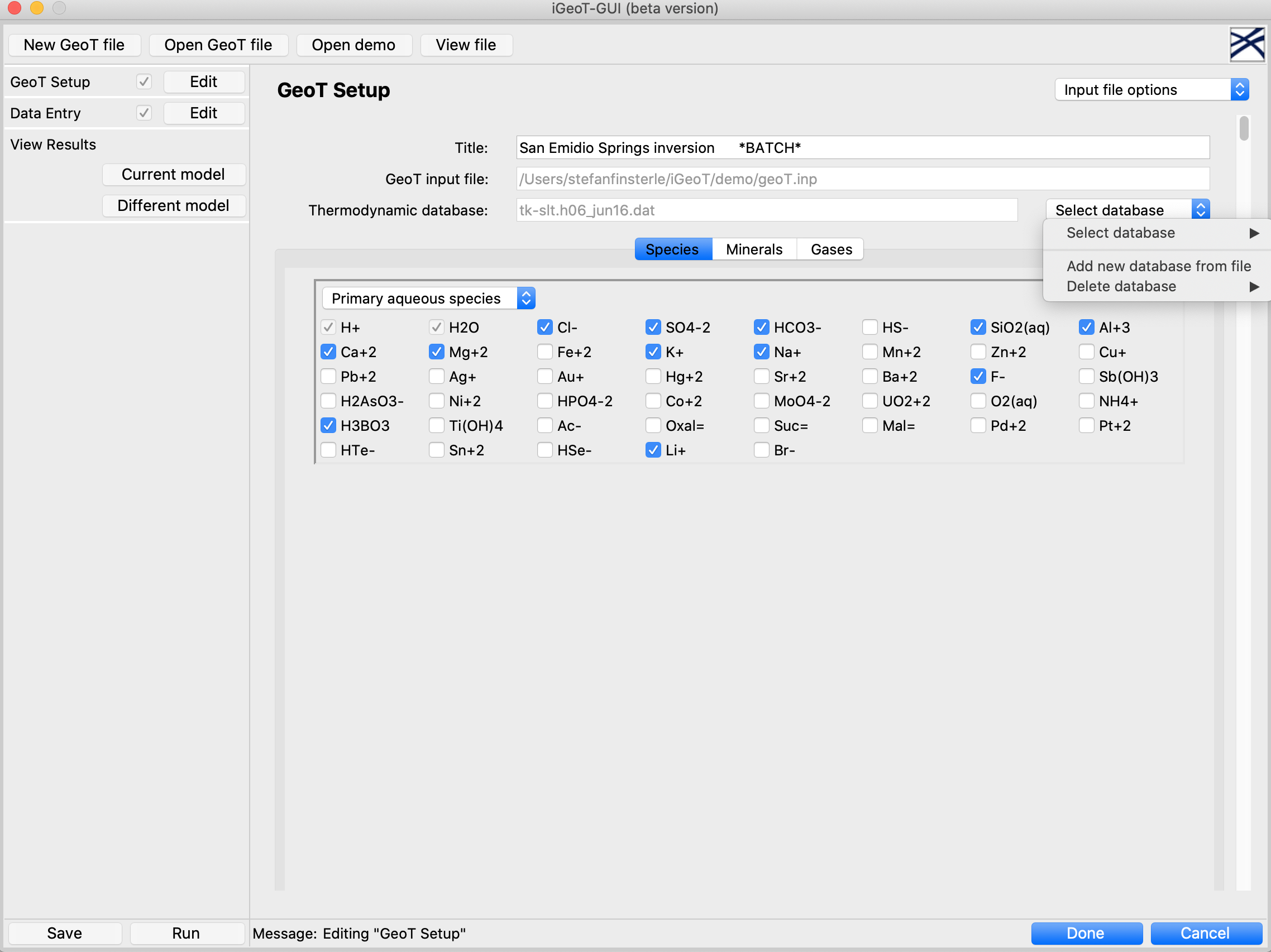
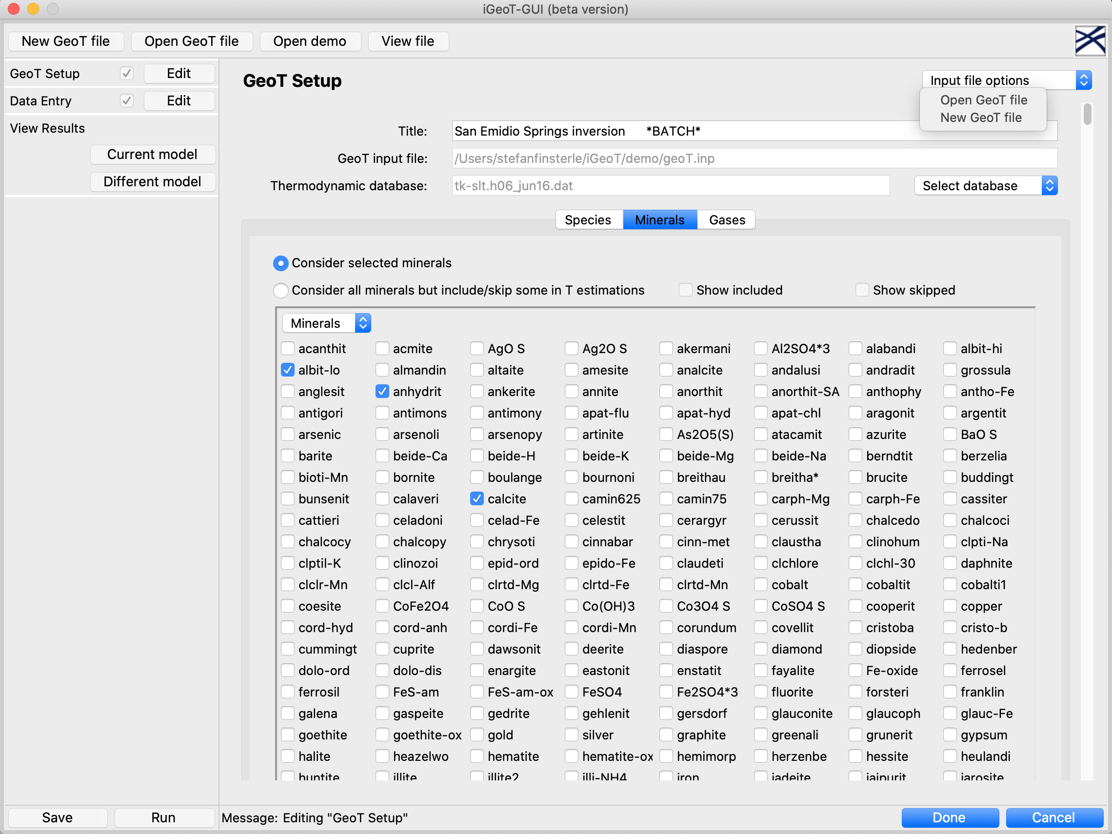
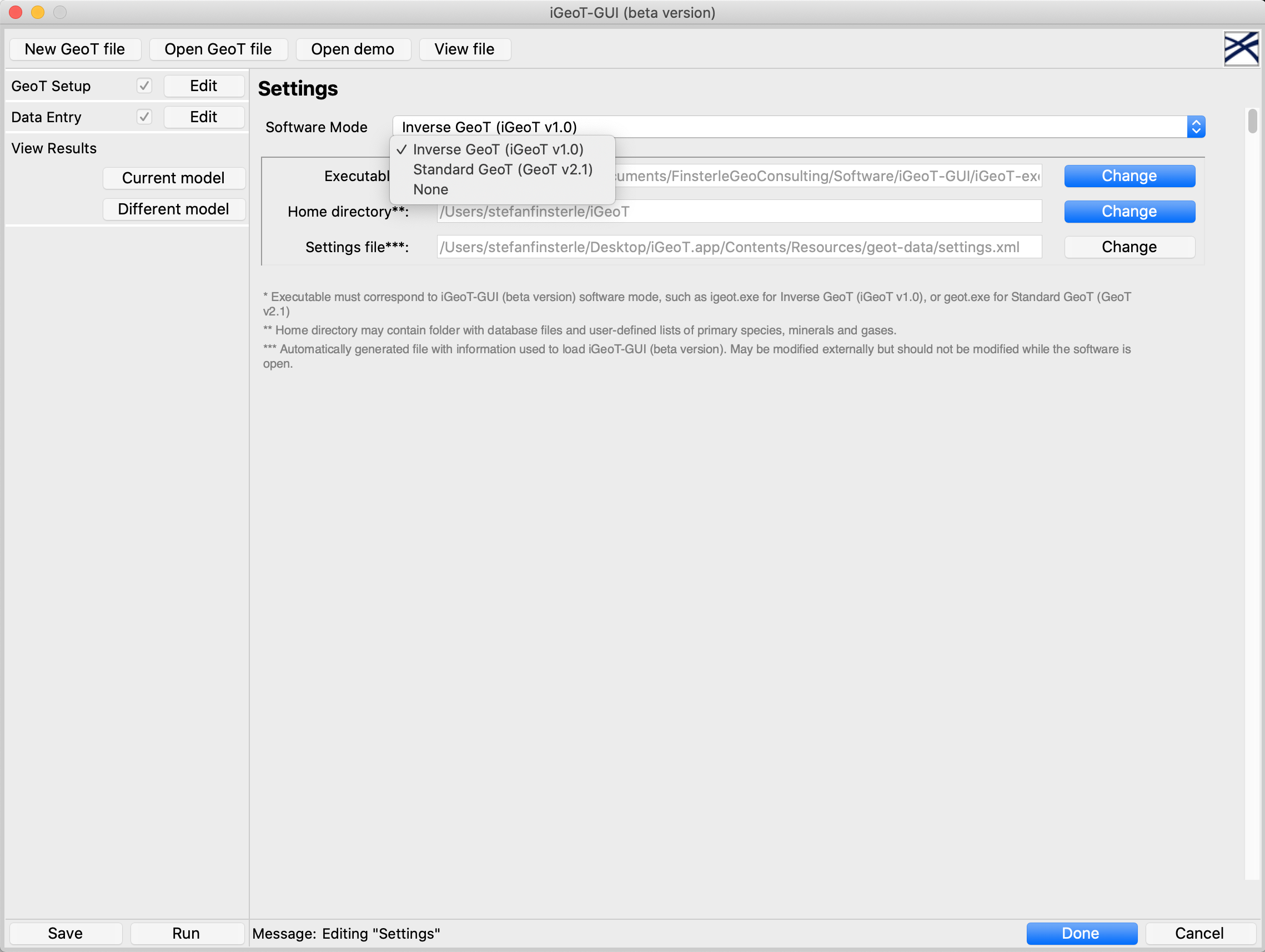
The iGeoT graphical user interface supports setting up the GeoT multicomponent geothermometer and formulating and solving the associated parameter estimation problem.
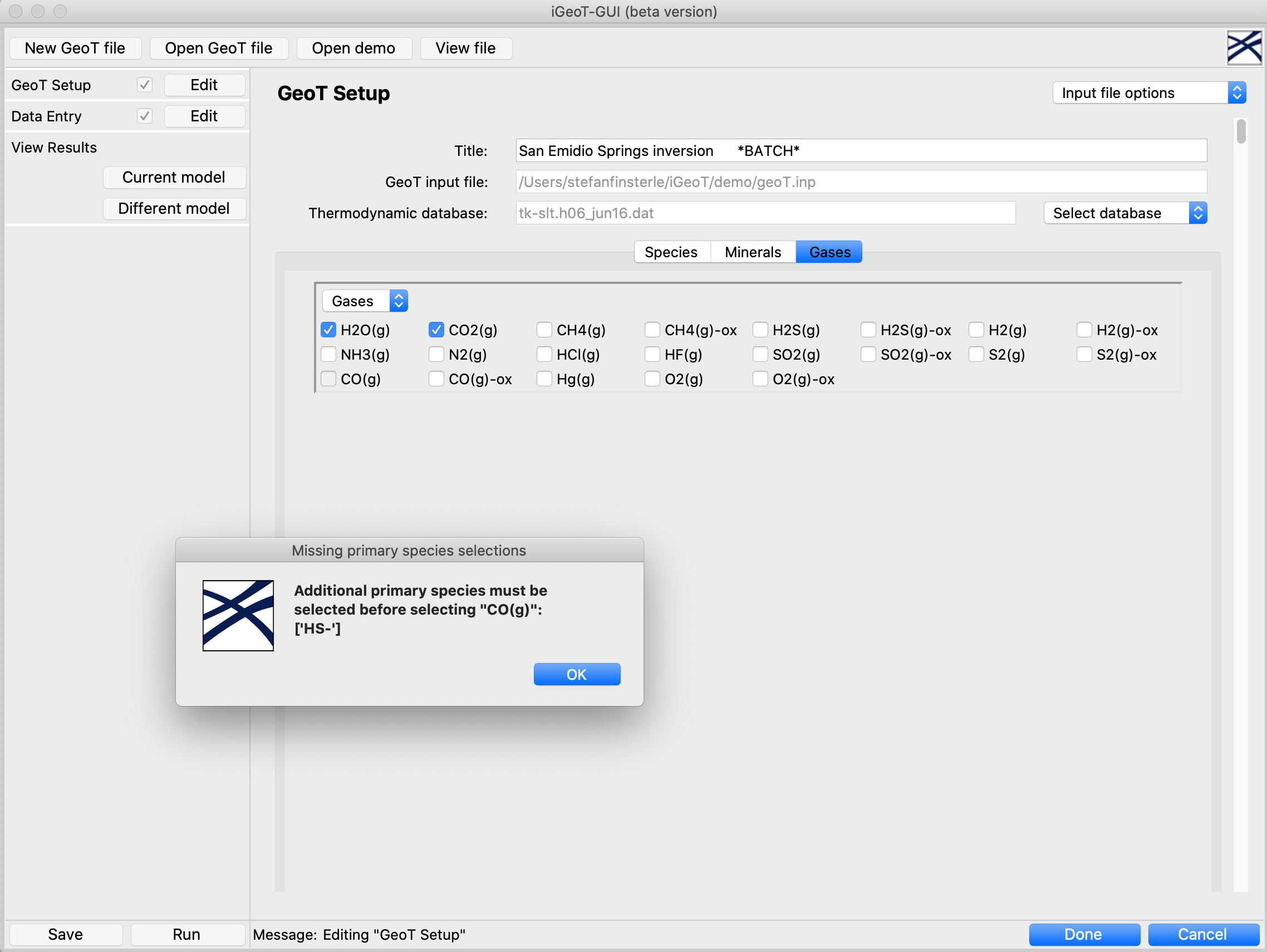
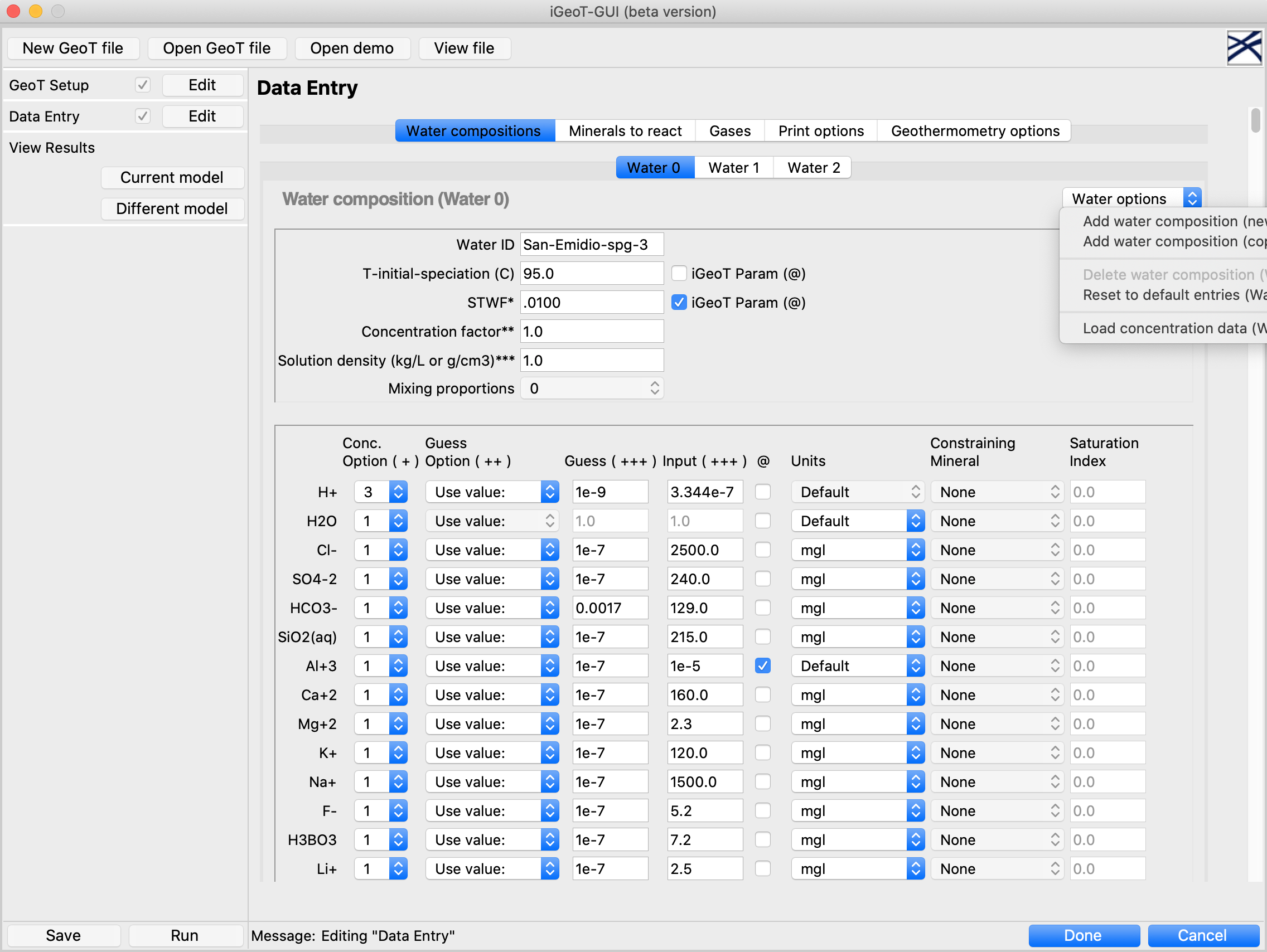
The user can select from a list of available primary aqueous species, minerals, and gases, and enter the composition of one or multiple waters. Potential inconsistencies in the user-defined reaction network are immediately identified, and corrections are suggested. Unknown or uncertain input parameters can be selected by clicking on the corresponding check box, and they will be automatically estimated by iGeoT. The estimated reservoir temperature and related statistics are displayed, and the clustering of the lines of temperature-dependent saturation indices is visualized. The screen shots and tutorials shown below provide an overview of iGeoT and how the graphical user interface supports its usage.
Documentation
The GeoT multicomponent geothermometer is documented in the GeoT User’s Guide. The iGeoT automatic parameter estimation tool for GeoT is documented in the iGeoT User’s Guide.
Pricing and Licensing
GeoT and iGeoT (without the graphical user interface) are separately licensed and distributed by Lawrence Berkeley National Laboratory (LBNL). An end-user license for GeoT or iGeoT must be obtained from LBNL prior to purchasing the graphical user interface iGeoT-GUI. Additional information about GeoT and iGeoT can be found at LBNL’s GeoT website.
The graphical user interface iGeoT-GUI is a separate, stand-alone software tool that links to either GeoT or iGeoT distributed by LBNL.
The price for the iGeoT-GUI graphical user interface is $300 for non-commercial users (academical, non-profit and government organizations) and $900 for commercial users. Please read the end-user license agreement for iGeoT-GUI.
You can purchase the graphical user interface iGeoT-GUI by credit card for immediate download of the software. For other payment methods, please contact the developers.
Disclaimer
iGeoT-GUI is supplied “as is” without warranty of any kind, express or implied (see License Agreement). However, a full refund will be issued should iGeoT-GUI fail to install on a particular platform.
Support
Limited free user support is provided for installing and running iGeoT-GUI.
Support contracts are available for scientific and technical help with geothermometry.
Please contact the iGeoT-GUI developers.
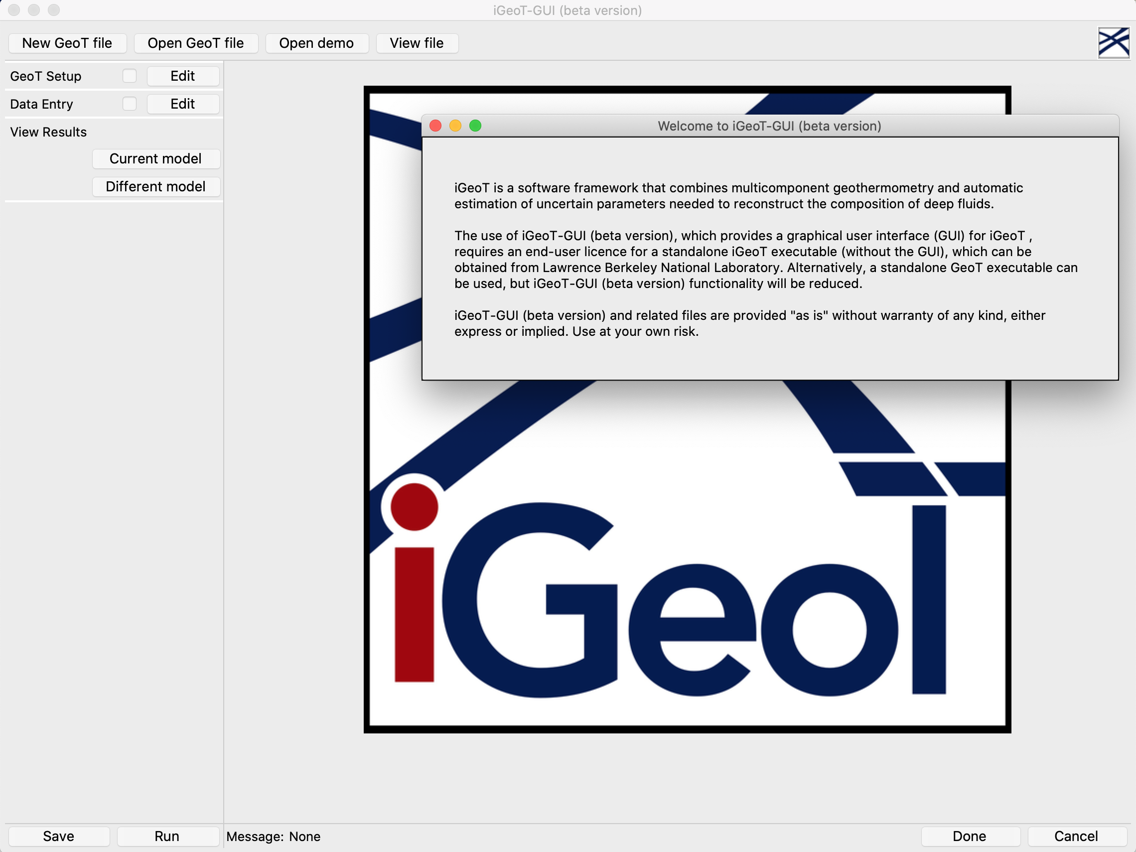
Screenshots from iGeoT-GUI Graphical User Interface
Tutorials
A series of tutorial videos explaining the capabilities, features and usage of iGeoT-GUI are posted here.
Developer Teams
GeoT was developed by: Nicolas Spycher, Loïc Peiffer, Eric Sonnenthal
iGeoT was developed by: Nicolas Spycher, Stefan Finsterle
iGeoT-GUI was developed by: Michael B. Kowalsky, Stefan Finsterle, Nicolas Spycher
